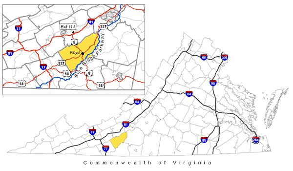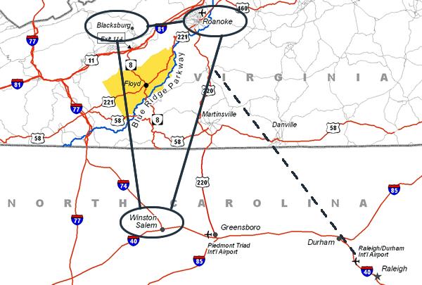
Get Directions
From Interstate 81: Exit 114 and follow Route 8 S to Floyd
(approximately 20 miles)
From Interstate 77: Exit 14 and follow 221 N to Floyd
(approximately 30 miles)
From Roanoke: Follow 221 to Floyd (approximately 40 miles)
From the Blue Ridge Parkway: The Blue Ridge Parkway follows the entire southern border of Floyd County so there are several access points to Floyd County. From the Tuggles Gap area, take Route 8 north to the Town of Floyd. From the Rocky Knob area, take scenic Black Ridge Road to 221.